
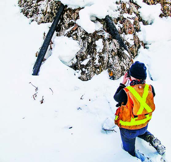
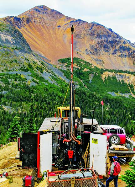
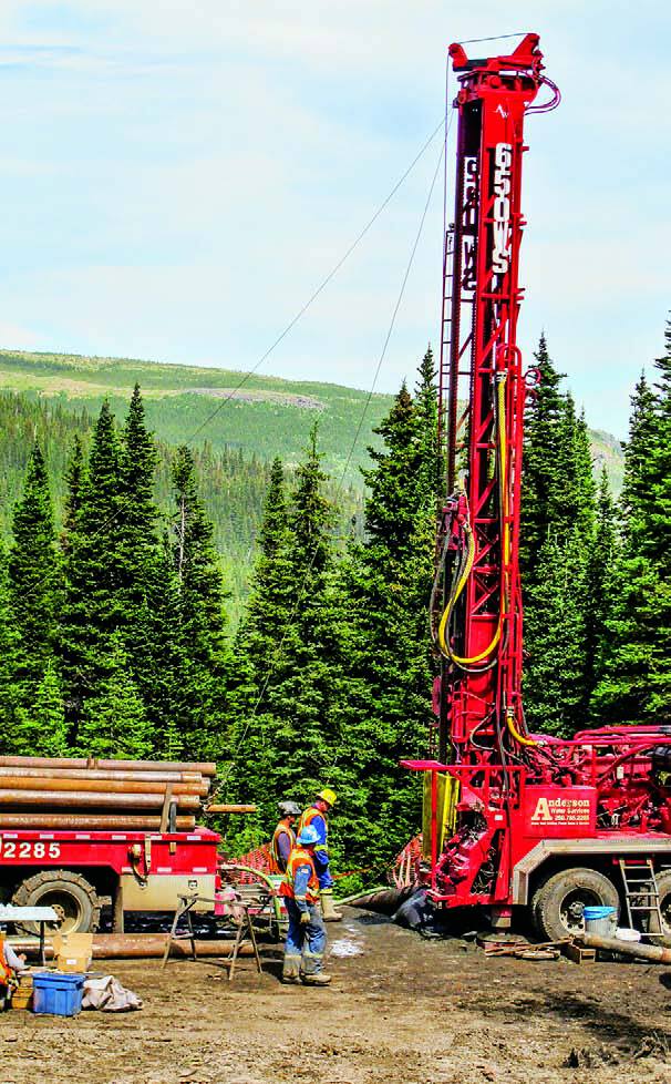
Exploration activity in British Columbia was predictably off the peak seen in 2012, when junior explorers were already experiencing difficulty raising venture capital, particularly for their less advanced projects. Regardless of funding, the exploration targets and ideas persist. Many projects made notable progress in 2013, and discoveries continue to generate excitement.
Coal, gold and copper top the list of commodities sought, as has been the case in recent years. Zinc projects were notably active in the Kechika Trough and elsewhere.
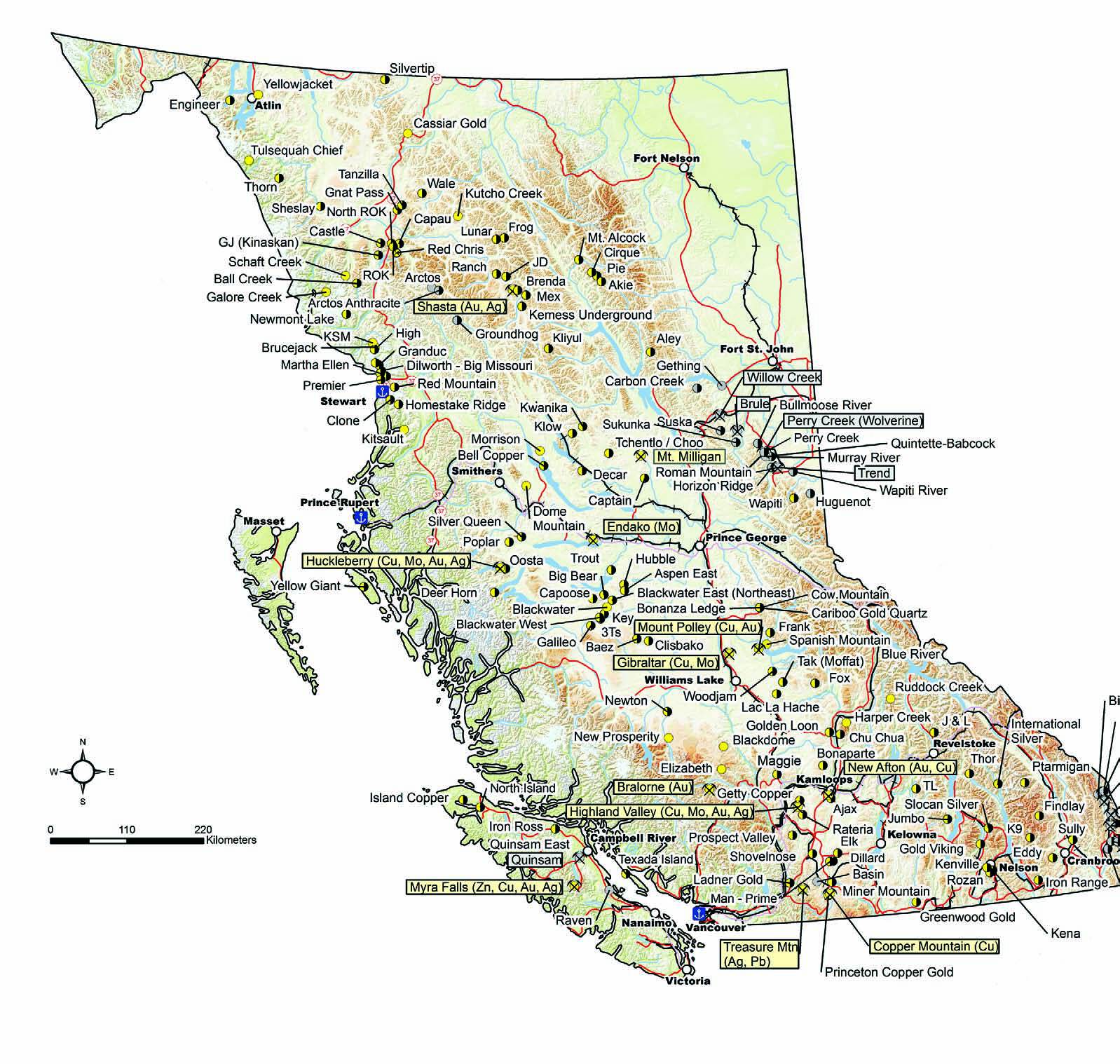
Projects around the province are broadly divided by deposit type and commodity.
Gold Projects
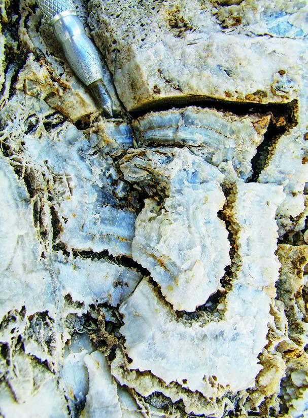
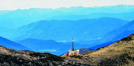
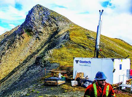
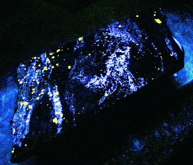
North of Stewart, Pretium Resources Inc. completed a 10,000-tonne underground bulk sample at its high-grade Brucejack gold project, near Seabridge Gold’s KSM Project. Drilling this year returned 61 intercepts grading over 1,000 g/t Au. Gold distribution in sheared, deformed veins is difficult to predict but indisputably present. An updated resource estimate for the Valley of the Kings incorporating this year’s drill results, and complete results of the bulk sample program, is expected in early 2014. South of Brucejack, Teuton Resources Corp. drilled its High property where grab samples have returned high-grade gold values.
Banks Island Gold Ltd. continues to advance the Yellow Giant gold project 120 kilometres south of Prince Rupert. Several structural gold targets at the Kim, Tel, Bob and Discovery zones were drilled, and a new road network across the property dramatically improved exploration access and potential portal locations for an underground bulk sample. Approximately 200 kilometres to the east, Deer Horn Metals Inc. released a preliminary economic assessment for the Deer Horn gold silver-tellurium project based on a 74,000-tonne-per-year millfeed rate.
In the Toodoggone district, Tower Resources Ltd. identified eight geo- chemically anomalous targets at JD. Ground IP and drilling extended the Finn zone 400 metres to the west, and porphyry-style mineralization was discovered a kilometre to the east. At Ranch, Guardsmen Resources conducted an infill soil survey.
On the Nechako Plateau, New Gold Inc. began feasibility studies at the Blackwater project. Drilling to the end of 2012 increased the resource to 9.50 Moz Au and 70.13 Moz Ag (M & I) to support a proposed 60,000-tonne per-day open-pit operation with a mine life of 16.4 years. Exploration focus switched to targets generated by a regional program and combined a suite of techniques including drilling at Capoose, Van Tine, Van Tine South, Fawnie, Emma, Blackwater South/East and Auro.
Elsewhere on the Nechako Plateau, Independence Gold Corp. followed up on gold and silver drill results at 3Ts and drilled the Ted-Mint gap area, Ted vein, and the Larry and Tommy veins. Grassroots and magnetic survey work continued. At Big Bear, Parlane Resource Corp. reported mineralized intercepts at the Black Bear anomaly. At Trout, Venerable Ventures Ltd. reported on drilling and trenching in the Camp zone. At Blackwater West, RJK Explorations reported anomalous silver-copper-zinc-lead values in the West Grid 4 target area and a ground IP and magnetic survey followed. At Aspen East, Redhill Resources Corp. drilled IP anomalies while grassroots work continued on the northern part of the property. At Key, Troymet Exploration Corp. reported on reverse circulation drilling that tested four target areas.
Tower Resources Ltd. conducted geophysical surveys at its Baez property aimed at defining the scale of the Camp, Clusko and Boulder Ridge South targets. Geoscience BC purchased recent Galileo and Hubble airborne magnetic data from Amarc, extending the TREK dataset west and northwest. The TREK project will deliver updated geophysical, geochemical and geological data for 20,000 square kilometres of the Nechako Plateau.
In the Cariboo, Spanish Mountain Gold Ltd. drilled a series of reverse circulation holes in the centre of its Spanish Mountain sediment-hosted gold deposit near Likely to test whether this method of drilling could yield more accurate grades. Barkerville Gold Mines Ltd. resumed public trading in October and reported activity at its Cow Mountain, Island Mountain and Barkerville Mountain areas as well as its Bonanza Ledge deposit.
At the Elk project, between Merritt and Peachland, Gold Mountain Mining Corporation drilled deep IP targets and advanced prefeasibility work towards extending the historic pit.
In the Kootenay Region, Taranis Resources Inc. released a resource estimate on its Thor property, where exhalative-type base metal sulphides on the west limb of the Thor antiform are a target. Activities were focused mainly on gold mineralization at the SIF zone and consisted of geochemical sampling, mapping and chip/panel sampling of a gold-bearing quartz veining system.
In the Coquihalla gold belt of southwestern B.C., New Carolin Gold Corp. conducted surface exploration at its Ladner Gold project, following a late-2012 drill program. The company relocated and revisited historical mines and showings, compiled recent drill results and took additional samples of Carolin Mine tailings for metallurgical study. If reprocessing is viable, the tailings are a potential source of revenue to fund exploration.
Porphyry (Cu-Au, Cu-Mo, Mo) projects
Colorado Resources Ltd. showed the exploration community that discoveries still generate excitement after its first drill hole into the North ROK property in April. The Mabon showing was originally identified during regional mapping completed by the BC Geological Survey in 1995. Colorado workers identified alteration assemblages similar to alkalic-type porphyries like the neighbouring Red Chris mine development.
Construction at Imperial Metals Corporation’s Red Chris peaked this summer and remains on schedule for commissioning by May 2014. The 287 KV Northwest Transmission Line and northern extension destined to bring power to Red Chris also remain in full construction.
There were several other significant projects in the Iskut region. Oz Minerals Ltd. partnered with Firesteel Resources Inc. to drill and complete a geophysical survey at the ROK property located between Red Chris and North ROK. West Cirque Resources Ltd. partnered with Freeport McMoRan Copper & Gold Inc. to drill the Castle project and undertake early-stage work at the Tanzilla project. Prosper Gold Corp. optioned the Sheslay property from Firesteel Resources Inc. and drilled for copper-gold porphyry mineralization deeper than previous workers. The GJ joint-venture project between Teck Resources Ltd. and NGEx Resources Inc. was also drilled.
Teck bolstered its commitment to exploration and development in northwestern B.C. by executing a 75 per cent back-in option at the Schaft Creek project with Copper Fox Metals Inc. In addition, Teck completed a resource drilling program in the Legacy zone at the Galore Creek project, which remains jointly owned with Novagold Resources Inc.
In the Stewart area, Seabridge Gold Inc. drilled the Deep Kerr and Iron Cap zones at the KSM project. Copper-gold grades were significantly higher than current reserves for the project. An application for an environmental assessment certificate is underway with a decision due in early 2014.
Northwest of the Sulphurets Camp, Romios Gold Resources Inc. reported a discovery at its Newmont Lake project where 100 chip samples, averaged over an area of several hundred square metres, indicate a porphyry copper-gold target at Burgundy Ridge. To the south, along a hypothetical extension of the Sulphurets fault, Brigade Resources Ltd. and joint venture partner Teuton Resources Corp. completed a substantial drill program at the Tide – Tennyson properties. Ascot Resources Ltd. reported more auriferous drill results from both the Martha Ellen and Premier project areas while Banks Island Gold Corp. continued to reinvestigate the Red Mountain property with surface work and drilling.
Production at Imperial Metals’ Huckleberry Mine, co-owned with the Japan Group (Mitsubishi Materials Corporation, Furukawa Co. & Dowa Mining Co. Ltd.), continues simultaneously with the Main Zone Optimization plan and constant amalgamation of historic data to generate future exploration targets.
Just eight kilometres south of Huckleberry operations, Gold Reach Resources Ltd. drilled the Ox and East Seel targets at the Ootsa project, attaining positive copper gold-molybdenum-silver results: for example, 160 metres grading 0.44 per cent Cu + 0.53 g/t Au from 30 metres depth, and 158 metres grading 0.42 per cent Cu + 0.45 g/t Au from 32 metres depth at East Seel.
Avanti Mining Corp. has received a conditional environmental assessment certificate for the past-producing Kitsault molybdenum mine. Construction is anticipated once additional permits and funding are in place.
In the Toodoggone district, Canasil Resources Inc. drilled a deep hole at Brenda to extend 2007 drilling that ended in gold-copper mineralization. Grassroots programs included International Samuel Exploration Corp. at the Frog property where copper-silver-gold anomalies were outlined at the Forax and Whoa prospects, and Stratton Resources Inc. identified a copper-gold anomaly at the Lunar project. AuRico Gold Inc. released a positive feasibility study for the Kemess Underground ( KUG) project t hat included a 24,600-tonne-per-day block cave operation with a 12-year mine life and utilization of existing infrastructure from the former Kemess South mine. Drilling resumed outside reserves at Kemess East, returning strong QSP alteration and intercepts up to 1.5 g/t Au, 3.0 per cent Cu and 0.018 per cent Mo at depth.
In the Quesnel Terrane, the $1.6-billion Mt. Milligan mine construction project became an operating mine. Commercial production of copper-gold concentrate began in the fourth quarter. As a greenfield Cu-Au porphyry project that moved through exploration into production, it stands as an encouraging example.
Elsewhere in the Quesnel Terrane, Kiska Metals Corp. conducted ground geophysical surveys, core re-logging and mapping at the Kliyul project to validate targets and define geological controls in the Kliyul zone where 2006 drilling intersected a promising coppergold target. Serengeti Resources Inc. announced a positive preliminary economic assessment at the Kwanika project for a 15,000-tonne-per-day operation with open pits at the Central and South zones, and two block cave areas below the Central zone. The mine would produce copper, gold, silver and molybdenum over a 13.5-year life. Geochemical data analysis indentified a deep porphyry target northwest of the Central zone. Orestone Mining Corp. reported significant copper-gold intersections in late 2012 drilling at Captain. Followup ground magnetic surveys outlined nine drill targets and the Admiral and East Magnetic areas were drilled.
Additional grassroots-level programs in the Omineca region included BC Gold Corp. at Rainbow; Canasil Resources Inc. at Lil and Vega; Chumar Exploration at Koko; Doubleview Capital Corp. at Mt. Milligan North; Far Resources Ltd. at Tchentlo Lake; Kiska Metals Corp. at Redton; Rich Rock Resources at Tas and Eagle; Serengeti Resources Inc. at Osilinka, Rottaker, SYL and Fleet; and West Cirque Resources Ltd. at Heath.
Around the Takomkane batholith, east of Williams Lake, Gold Fields Horsefly Exploration Corp. released a new resource calculation for the Woodjam copper-gold porphyr y deposit, which now stands at 227.5 million tonnes grading 0.31 per cent copper (indicated). The calculation includes the Southeast, Takom and Deerhorn zones. Happy Creek Minerals Ltd. reported good drill intersections on its Ridley Creek zone at the Fox tungsten skarn property northeast of 100 Mile House.
Constantia Resources Ltd. commenced drilling at the Maggie porphyry copper prospect located north of Cache Creek. Work started after a program of community engagement that may set a new standard for the industry.
The largest exploration effort in the Guichon batholith (and possibly in the province) was by Teck Resources Limited near its Highland Valley copper-molybdenum mine near Logan Lake. Up to nine drill rigs were active at the Valley and Bethlehem pits.
Within the Iron Mask batholith, near Kamloops, KGHM International continued engineering and baseline studies needed to advance its Ajax porphyry copper-gold project through federal and provincial environmental review processes. New data may result in substantial changes to project layout and design.
Between Princeton and Merritt, Fjordland Exploration Inc. and Sumac Mines Ltd. commenced a phased program on the Dillard porphyry copper gold project, including mapping, geophysics and drilling. Sunrise Resources Ltd. completed a small drilling program at the Man-Prime property.
Near Princeton, exploration at Copper Mountain Mining Corporation’s namesake Copper Mountain Mine focused on areas north of Pit 2, on the Alabama trend, and south of Pit 3, with positive results. Sego Resources Inc. used reverse circulation drills to test the Cuba, Upper Regal, and Quintana zones at its Miner Mountain copper-gold project. Anglo Canadian Mining Corp. drilled the Combination zone of its Princeton copper-gold project adjacent to Copper Mountain Mine.
Geoscience BC released geophysical and geochemical results of its Northern Vancouver Island Project in 2013. Junior and major companies followed with staking and initial reconnaissance work. Despite advances in 2011/2012 and a permit for additional drilling, Northisle Copper and Gold chose to put its copper-molybdenumgold North Island project on care and maintenance pending improvement in venture capital markets.
Polymetallic base & precious metals
Early in 2013, Chieftain Metals Corp. released a positive feasibility study for the Tulsequah Chief polymetallic project and received final permits for the development of the project. Exploration proceeded this year with new targets at the Tulsequah Chief, Big Bull and Banker/ Sparling areas.
In the Kechika Trough, Canada Zinc. Metals Corp. expanded the 2012 airborne VTEM survey to include the remaining Kechika Regional properties while hydro-geochemical work continued at Kwad and Weiss. Drilling at Akie tested four targets. Mapping and soil sampling continued at Mt. Alcock and Akie, resulting in a discovery named the Sitka showing.
Teck Resources Ltd. re-established the Cirque camp and drilled deep targets at North and South Cirque. Mapping covered several areas of interest while soil sampling was conducted at Cirque, Fluke and Elf. In September, Teck Resources Ltd. optioned the Pie, Cirque East and Yuen properties that are contiguous to its Cirque project, and exploration commenced there in October.
At the Ruddock Creek lead-zinc project, east of Vavenby, Imperial Metals Corporation focused on engineering, metallurgy and environmental baseline studies on this Monashee-type, massive sulphide prospect in preparation for a feasibility study and formal environmental review in 2014.
Barker Minerals Ltd. focused on its Frank lead-zinc prospect, a Kuroko-style VMS target east of Likely. The prospect occurs in an overturned sequence of Cambrian-age volcanic and sedimentary rocks.
The Adams Plateau area, east of Barriere, saw renewed interest after several quiet years. Exploration is anchored by continued work on Yellowhead Mining Inc.’s Harper Creek Project, which is now being prepared for formal environmental review. Newport Exploration Ltd. acquired the Chu Chua massive sulphide deposit from Reva Resources Corp. and commenced metallurgical testing. Astral Mining Corporation optioned the Barrier Ridge and Honeymoon projects. Victory Ventures Inc. optioned the Fortuna claims. First Americas Gold Corporation reported successful use of Ah horizon soil geochemistry and novel VLF inversion techniques on its Kamloops Copper-Gold property near Chu Chua.
Northeast of Revelstoke, Huakan International Mining Inc. continued prefeasibility metallurgical test work at the J&L gold-silver-lead-zinc property at the north end of the Kootenay Arc trend.
In the East Kootenays, there was ongoing exploration for Sullivan-type base metals and related polymetallic vein systems. Northwest of Fort Steele, MMG Limited continued exploration on the Findlay property for stratabound and exhalative-type sulphide mineralization. The year’s program included geochemical sampling, gravity and magnetic surveys.
Also near Fort Steele, Santa Fe Metals Corp. drilled deep targets at the Sully property to test a deep gravity anomaly in Sullivan-time rocks. The drilling used enhanced drill stabilization techniques and oriented core to target depths of over 1,500 metres.
Bluefire Resources Ltd. prospected, mapped and sampled the K9 property east of Kimberley in search of strata bound massive sulphide mineralization. The work tested anomalies identified by a regional TEM geophysical survey.
On central Vancouver Island, underground exploration drilling continued at Nyrstar NV’s Myra Falls operations, seeking extensions to mineralized zones and additional VMS lenses. In recent years, exploration and definition drilling has generally replaced reserves at about the same rate they are mined. There were some disruptions to production in 2013, but higher grades were anticipated toward the end of the year, partially making up the shortfall.
While silver is more typically a byproduct or potential coproduct in B.C., silver is the primary commodity at several polymetallic prospects.
In northwestern B.C., Brixton Metals Corporation reported positive drill results from the Oban zone at the Thorn project, where targets are high-grade silver-gold-lead-zinc diatremebreccia zones and high grade gold-silver-copper veins.
Early in 2013, Huldra Silver Inc. commenced production from its Treasure Mountain Mine, a high-grade silver-lead vein in the upper Tulameen watershed with milling at a 200-tonne-per-day mill near Merritt. Unfortunately, in June, both the mine and mill were placed on care and maintenance due to market factors and commodity pricing.
Silver Mountain Mines Inc. expanded its gravity geophysical, mapping and geochemical surveys at the Ptarmigan property, located near Radium. Targeting silver-bearing veins and manto-style sulphide mineralization, new mineralization and zone extensions were successfully identified.
Specialty Metals, Iron, Nickel, Industrial Minerals
In the northeast, Taseko Mines Ltd. continued metallurgical testing on Aley samples and successfully produced a niobium concentrate. Work in 2013 aimed at finalizing the process flowsheet for a feasibility study.
On Vancouver Island, in the Sayward area, an application to reopen Canadian Dehua International Mines Group’s Iron Ross magnetite mine is on hold pending further exploration. Among other iron skarn prospects on Vancouver Island, Dehua also acquired the Port Renfrew area property (Pearson project), formerly of Pacific Iron Ore, and conducted reconnaissance geological work in advance of planned drilling.
In the north-central interior, First Point Minerals Corp. reported that the extension of the Baptiste deposit at the Decar project has increased the indicated resource to 1.438 million tonnes of nickel. A positive preliminary economic assessment was announced for a 114,000-tonne-per-day open-pit operation producing 37,400 tonnes per year over 24 years. Cliffs Natural Resources Exploration Canada Inc. elected to fund a prefeasibility study for the project.
Exploration for industrial minerals is commonly unpublicized. Nevertheless, a few examples here represent activity in the sector.
Fertoz International Inc. continued hand-portable drilling, hand trenching and mapping at the Wapiti phosphate project northeast of Prince George.
In the Kootenays, Noram Ventures Inc. completed its Phase 1 drill program at the Jumbo property for flake graphite, with targets at the South Limb, Black Fly and Big Flake areas. Drill targets tested a sinuous EM conductor identified on a SkyTEM airborne geophysical survey.
On Texada Island, Lafarge Canada drilled the area surrounding its quarry to upgrade its limestone quality information. The inventory could last 100 years or more.
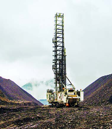
Coal
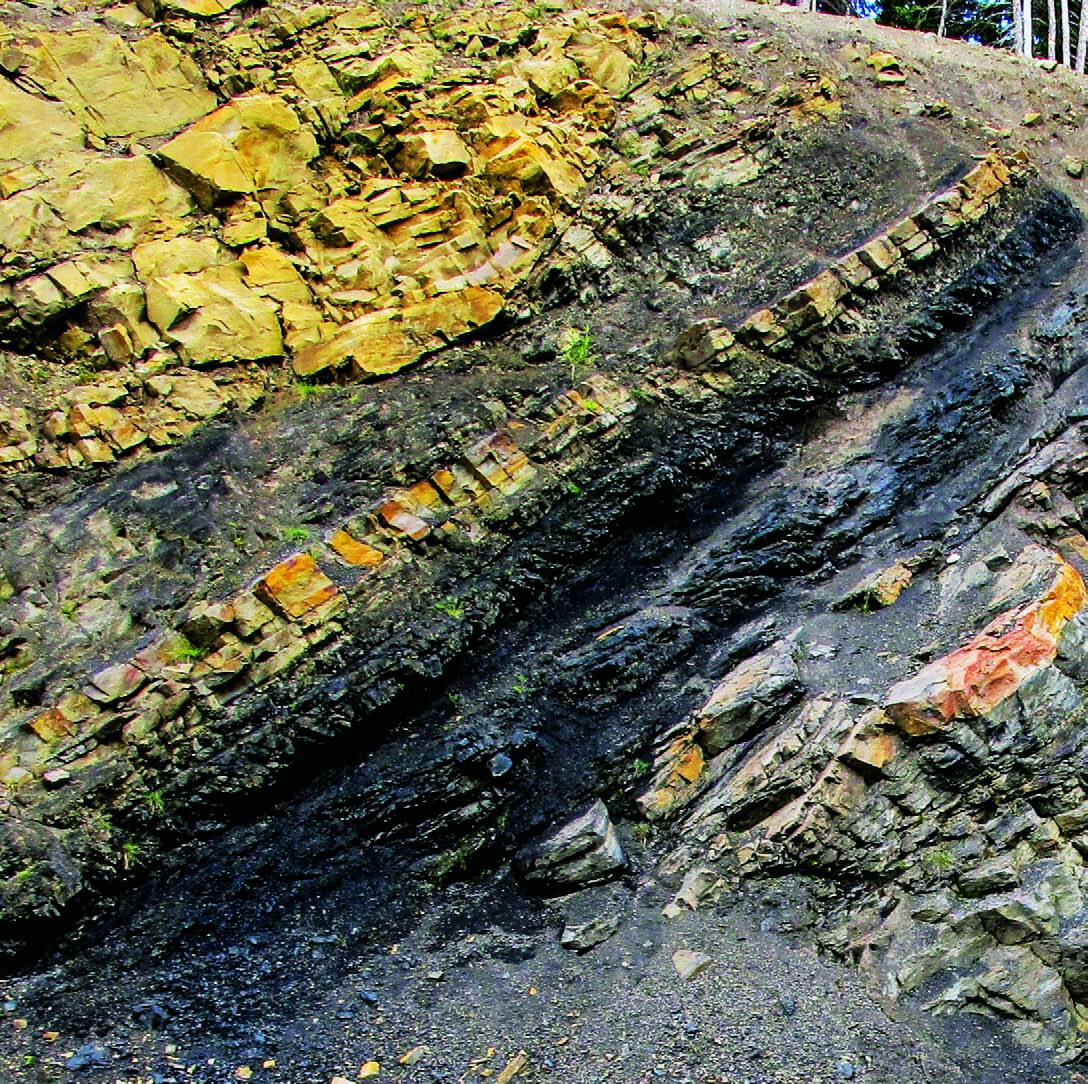
Most coal mined in B.C. comes from the southeast, where Teck’s five large mines produce over 21 million tonnes per year of mostly hard coking coal. The northeast is another major metallurgical coal district with a smaller share of production but very active exploration. Coal is also produced on Vancouver Island and in the Princeton area.
The Bowser Basin in northwest B.C. contains another potential producer, where Fortune Minerals Limited completed drilling and environmental baseline monitoring at its Arctos Anthracite project located southeast of Dease Lake. Atrum Coal also explored its Groundhog anthracite project southeast of the Arctos project.
In the Peace River coal field, Walter Energy Inc.’s on-lease exploration included drilling at Perry Creek to support current mining in Phase 4A and 2014 mining in Phase 4B; geotechnical drilling on the Brule Pit north wall and groundwater monitoring holes around the Brule Pit; and in-pit drilling at Willow Creek. Walter drilled at EB of the Wolverine property group, and conducted geotechnical work along the Perry Creek Road linking the EB expansion to the Perry Creek wash plant. Exploration work and drilling continued on the Brazion group properties: Hudette, Mink West and Mink East.
Anglo American plc drilled the Roman Mountain project to collect data on Gething Formation seams. Exploration and large-diameter core drilling was conducted on Roman Northwest. An experimental geophysics program began testing different subsurface mapping techniques on both properties to develop a geophysical signature for regional use. The program was to be extended to Belcourt North/ South later in the year.
Teck Resources Ltd. drilled at Quintette (Babcock) to upgrade reserve classification in the Window and Windy pits and explore the northeast fault area for pit design. Geotechnical drilling continued for water management features and borrow areas. Specific gravity circuit tests and pilot scale wash tests were completed on a bulk sample, and a pilot test sample was taken on lease.
At HD Mining International Ltd.’s Murray River project, work resumed in September on preparing the decline portal area for the extraction of a 100,000tonne bulk sample. A continuous mining machine has arrived on site. Canadian Dehua International Mines Group Inc. drilled the Wapiti underground prospect for coal quality and subsurface assessment. Glencore Xstrata plc drilled at Suska to December 2012, then at Sukunka from February to April 2013. Coal seams were trenched in the Nose Pit area for further examination. Colonial Coal International Corp. released a positive preliminary economic assessment for a combined surface/underground operation at Huguenot that would produce an average three million tonnes per year of clean coal over 31 years. A data review of the Flatbed underground prospect identified three target areas for initial exploration. Anglo American Exploration Canada Ltd. did regional reconnaissance work south to north across the coalfield at the Onion, Wolverine North/South and Willow South projects. Canadian Kailuan Dehua Mines Co. Ltd. received permitting approval for a 100,000-tonne bulk sample and surface facility site preparation at Gething, but no work was planned for 2013.
In the East Kootenay coal fields, near Fording River, Teck plans to drill the Henretta project late in the year. Near the Greenhills Operations, Teck drilled at the Swift area and also continues to drill the Cougar North expansion.
Teck Coal received conditional approval from the Environmental Assessment Office for the Phase 2 mine expansion at Line Creek that will include development of the Burnt Ridge North and Mount Michael areas. The expansion will provide approximately 52 million tonnes of clean coal and extend the mine life by an estimated 18 years.
Also in the Elk Valley Coal Field and south of Line Creek, Jameson Resources Limited released a resource estimate of 90 million tonnes for the Crown Mountain project. In addition, a preliminary economic assessment was completed, supporting a low-cost metallurgical coal mining operation. Drilling was completed at the North and South blocks.
Teck drilled reverse circulation and large-diameter reverse flood holes at the Marten Wheeler to better delineate geology prior to a bulk sample, and also drilled at the Coal Mountain project late in the year.
CanAus completed exploration and sonic core hole drilling at its Loop Ridge, Tent Mountain and Michel Head properties in the Michel Creek drainage. Based on the results of coal analysis and geological modelling, further exploration drilling is proposed.
In the Crowsnest coal field east of Fernie and west of the Coal Mountain mine, Crowsnest Pass Coal Mining Ltd. focused on geochemical modelling, quality and resource work at Coal Creek. The area has potential for underground mining of coking coal.
Moving much farther westward, Coalmont Energy Corporation commenced production at its Basin thermal coal mine near Princeton in June, working towards a production target of 350,000 tonnes per year in 2014.
On Vancouver Island, Hillsborough Resources Ltd. continued mine-site exploration drilling at its Quinsam thermal coal mine in 2013, targeting the No. 3 seam with the objective of developing the 4 South and proposed 6 South mines. Early in the year, Compliance Energy Corporation submitted its application for environmental certification of the Raven underground metallurgical coal project with the B.C. Environmental Assessment Office. The EAO found the application did not contain all required information. The company expects to submit a revised application in 2014.
BC Government Initiatives
The Government of British Columbia has a number of initiatives designed to aid and promote mineral exploration in the province. The 20 per cent B.C. mining flowthrough share tax credit remains in place with a current expiry date of December 31, 2013. This is harmonized with the federal 15 per cent flow-through tax credit.
B.C.’s 20 per cent refundable mining exploration tax credit for grassroots exploration remains in place for qualified expenses before January 1, 2017.
The system for submitting Mines Act Notices of Work moved online in 2013. Government had reduced average turnaround time for Notices of Work to 65 days as of mid-2013. A step toward streamlining permits went into effect September 1. In cases of an existing Mines Act Permit, several types of activity are now authorized: induced polarization surveys, exploration drill programs on existing mine sites, and extending the timing of proposed work by up to two years. Where possible, the ministry may issue area and multi-year permits.
Government-funded, industry-led Geoscience BC continued its work in 2013 in both hard rock and oil-and-gas geoscience data collection. Robin Archdekin assumed the position of president and CEO, replacing ‘Lyn Anglin, whose eight-year term saw much new data added to the province’s inventory. This work has, and will continue to, stimulate exploration in targeted areas.
A key theme in Geoscience BC’s work relates to porphyry exploration. The QUEST projects of 2007 to 2013 covered the porphyry-prospective Quesnel Terrane. The ongoing Porphyry Integration Project aims to maximize the value of these data with a study of geophysical, geochemical and geological signatures of deposits. Other major projects active in 2013 included the TREK (Targeting Resources through Exploration and Knowledge) project focusing on B.C.’s underexplored northern interior plateau region and the Northern Vancouver Island Project. The latter is funded in part by the Island Coastal Economic Trust, focused on an area of demonstrated potential in which local communities hope to reengage the mining industry.
The BC Geological Survey, established in 1895, is responsible for the collection, long term maintenance and delivery of geoscience information in the province. Its primary objective is to stimulate and facilitate exploration for minerals and coal.
The Geological Survey Branch had more than 20 field-based projects active in 2013, several in partnership with other agencies. Much of the focus is on porphyry environments, with mapping in the Nicola Arc and KSM-Stewart region. In addition, there are projects focused on exploration methods (porphyry indicator minerals and VMS geochemistry). Staff also undertook mineral deposit studies (Ni-Cu-PGE and specialty metals) and a number of compilation and other officebased projects.
At the Victoria headquarters, the Branch’s sample processing lab is functional again, as is a new XRF lab and a fluid inclusion lab. On the information technology front, the survey’s widely used digital geology map saw an update. The new version is based on a framework model that automatically generates polygons based on contacts and faults for a more seamless presentation of data, including new mapping. The next generation of the MapPlace, a series of map-based data portals, is in development. It is designed to improve appearance and performance while preserving the flexibility and search capability that made the original project a world leader in geoscience data delivery. The Branch continues to update Property File, making it an increasingly important repository of exploration data, now with more than 45,000 documents for free download. As with all of its products, the BC Geological Survey encourages its use. Donations of materials are welcome.